California and Nevada Smoke and Air Committee
|
California and Nevada Smoke and Air Committee |
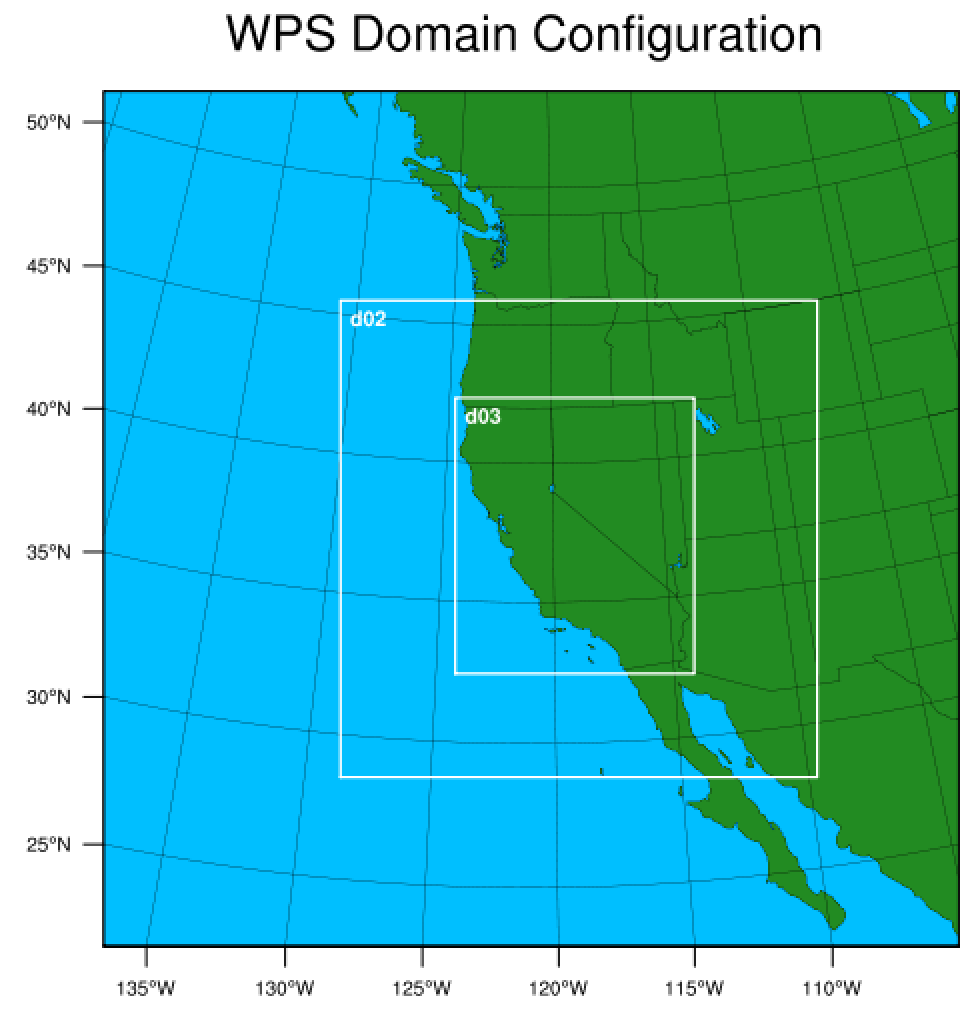
WRF Model ConfigurationThe Weather Research and Forecasting (WRF) Model employs the Lambert Conformal map projection centered at 38N, 121W and consists of three nested grids. The outermost grid (12 km horizontal resolution, 279x279x40 grid points) covers the western U.S., parts of Mexico/Canada, and the eastern Pacific. The nested grid (4 km horizontal resolution, 466x466x40 grid points) encompasses California, Nevada, Oregon, Utah, and parts of Idaho, Arizona, Wyoming, and Montana. The innermost grid (1.33 km horizontal resolution, 700x808x40 grid points) encapsulates the entire California and Nevada boundaries.
The geophysical input was derived using default terrain and land use data for all grids. The namelist.wps file is given here. The corner coordinates of each grid are given in Table1. Table 1. Coordinates of each model grid.
Twice daily forecasts are initialized using the National Centers for Environmental Prediction NAM model 00/12 UTC forecast outputs (Grid 218 - 12 km resolution) at 7 AM/PM PST. Currently, the real-time system generates 72-hr forecasts for all grids. The model outputs are saved in hourly intervals. The CANSAC real-time system utilizes the WRF model version 4.2.2 in a non-hydrostatic mode with two-way nesting. The vertical layers consist of 40 hybrid sigma-pressure vertical levels for each grid. Approximate corresponding heights of half-sigma levels in meters are:
Table 2. The WRF model physics options
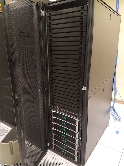
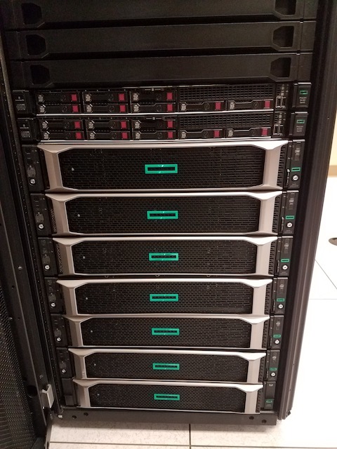
Postprocessing The CANSAC WRF real-time system uses the RIP (Read/Interpolate/Plot) version 4.7 visualization program along with NCL NCAR Command Language for all post-processing products. The code is being continuously improved to meet the needs of CANSAC users. Currently the set of visual products includes plots of ventilation index, Haines index (high and mid levels), lifted index, cloud water, planetary boundary layer height, precipitation, absolute vorticity and sounding plots/text files along with other standard parameters used in weather forecasting and atmospheric assessment applications. The model runs 3 domains, out to 72 hours in about 1.5 hours wall clock time and the entire post-processing is completed within about 2.5 hours. WRF output files are roughly 800 MB for all three domains per each hour. HardwareThe CANSAC WRF real-time forecast system is operated on an HPE Apollo 2000 high-performance computer. Specifications are:
|